
the emf database
Robert Thomas Sr. began building the EMF Geoscience Database over 30 years ago, and as a company, we are constantly expanding the database everyday. Our primary focus is in Ohio, with eastern Ohio having our most complete database. Our other data spans central Ohio, Pennsylvania, West Virginia and Michigan with new areas of interest being developed over time.
The Database utilizes the LMKR GeoGraphix Suite giving us the ability to store well data, create surface maps, and interpret 2D/3D seismic data.
ohio database
Covering over 42 counties (36 fully developed), our Ohio database includes over 200,000 wells. Data for those wells includes log files, rastered logs, depth registered log sections, .las files, survey data, geothermal data, formation tops, completion data, and production volumes. (For a more detailed inventory of our data, click here.)
Database coverage map

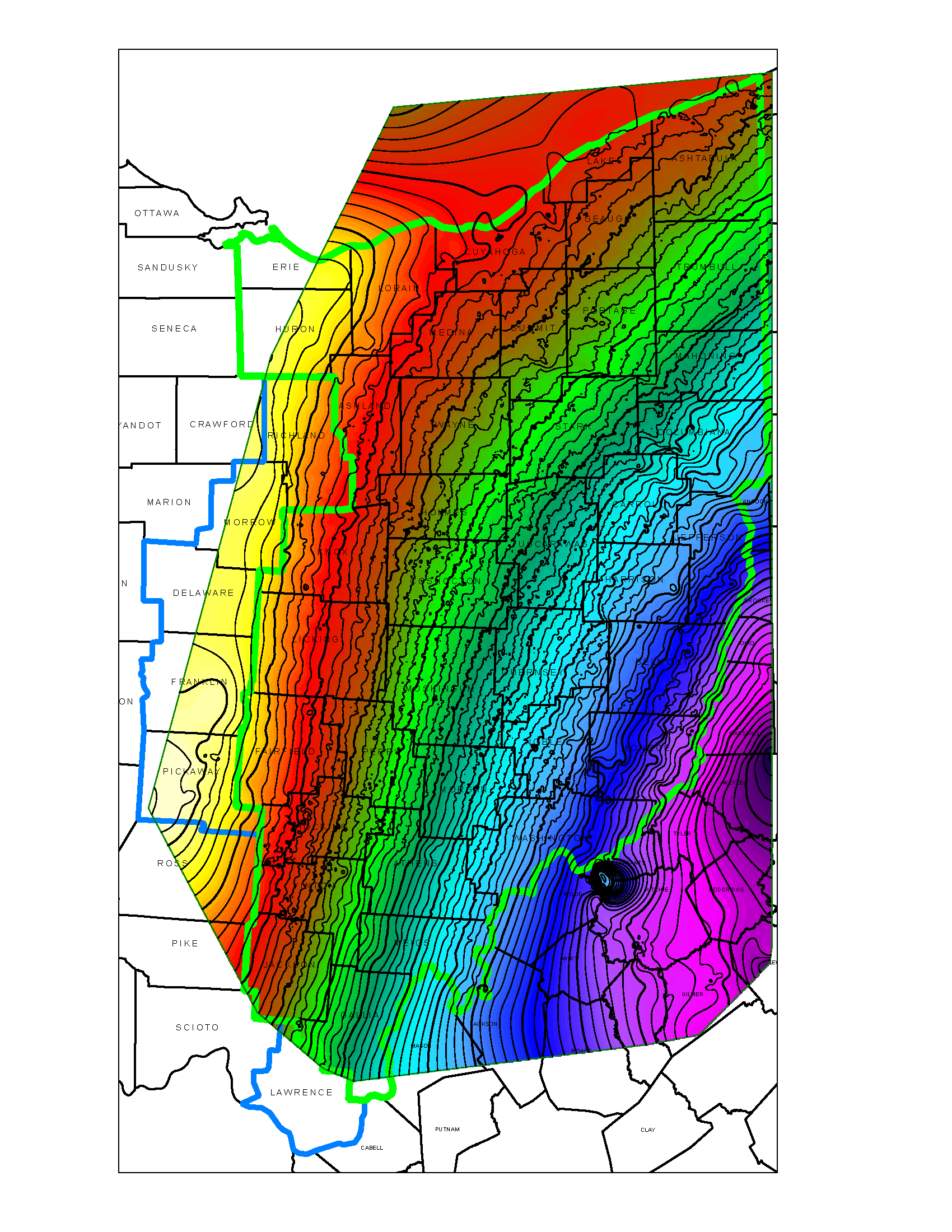
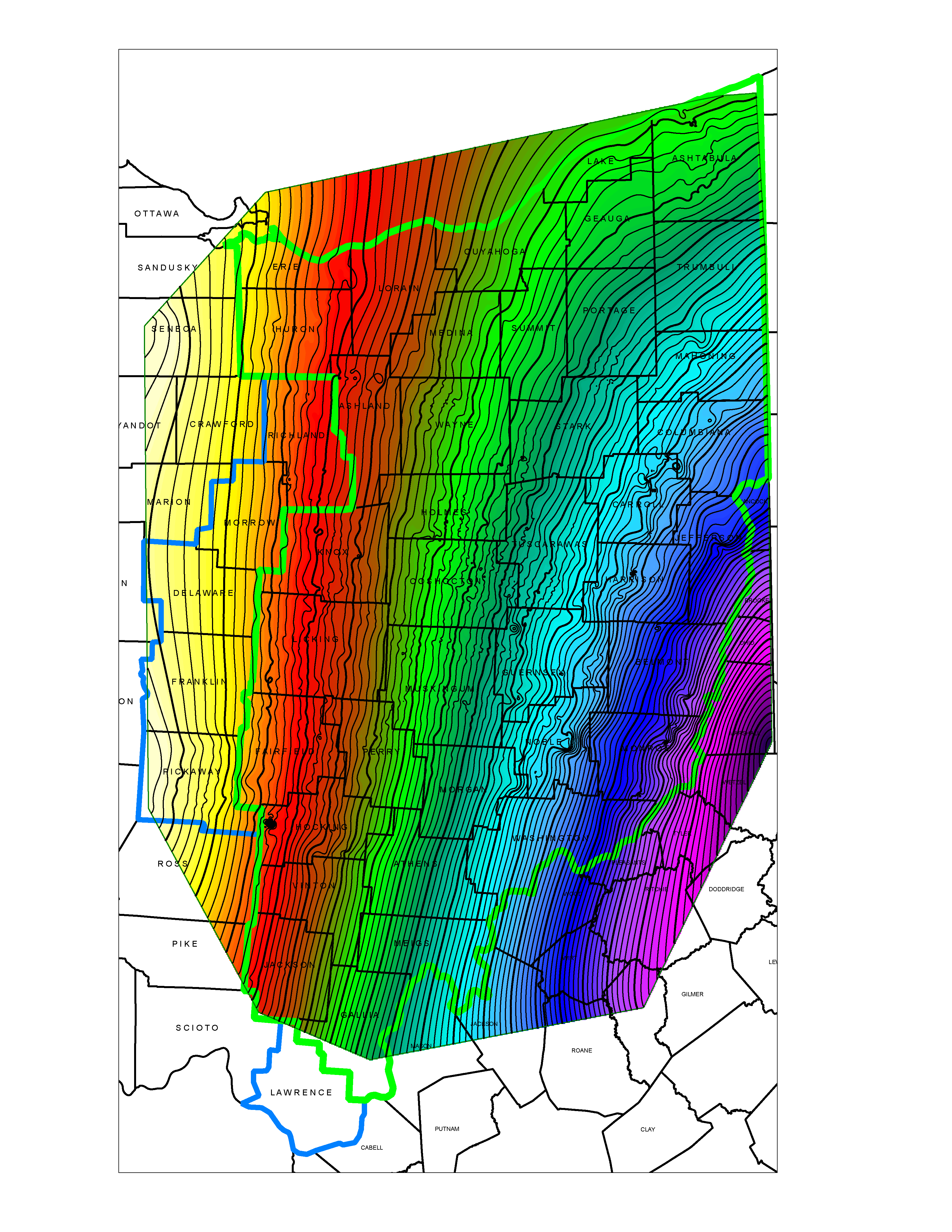
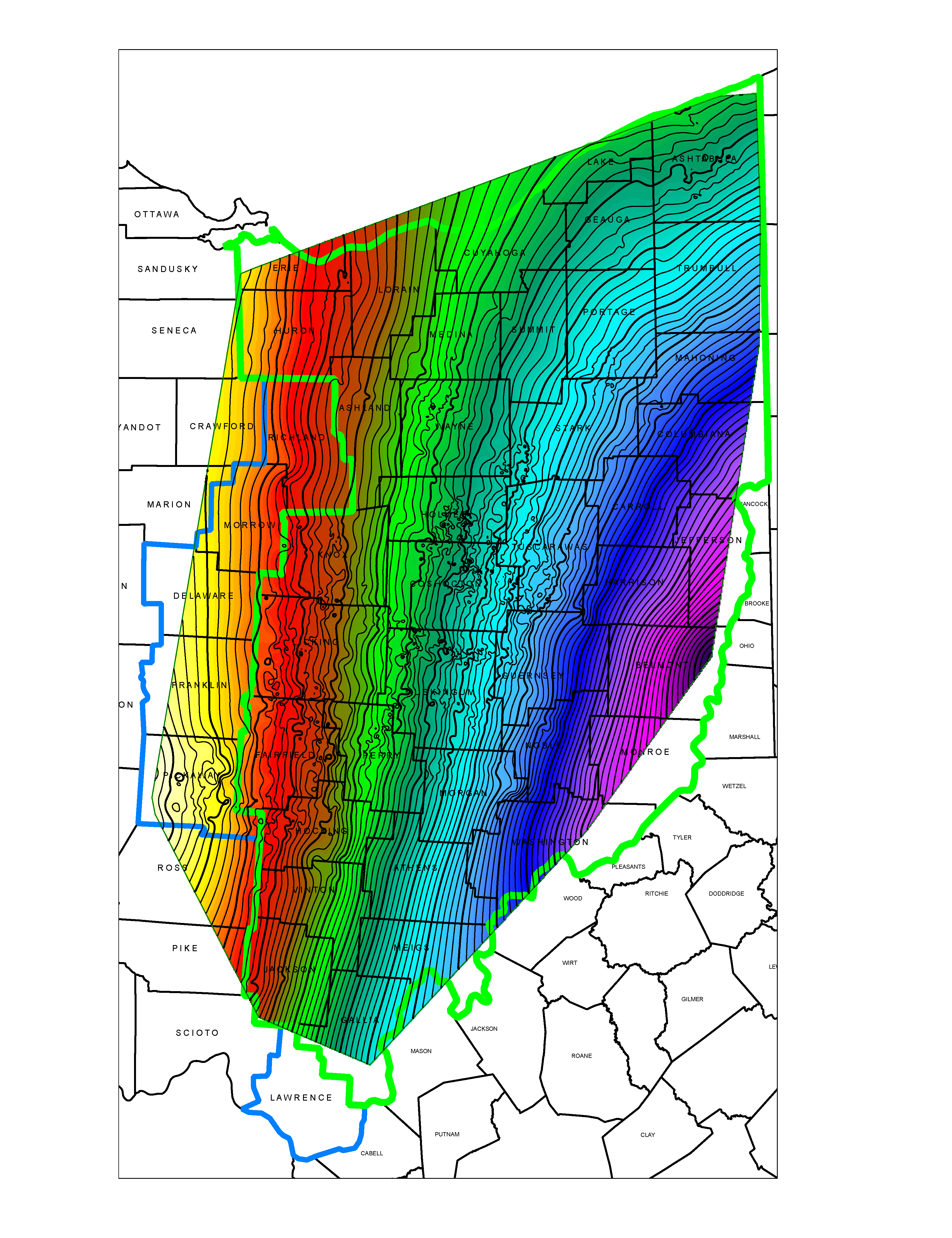
Residual Coverage Map of Base of Big Injun & Onondaga spanning OH, WV, & PA
base structure maps
swiw database
EMF is currently developing a searchable SWIW Database in Microsoft Access in order to identify injection intervals and determine realistic potential injection volumes within those intervals.
The SWIW Database includes information for over 500 Class 2 injection wells and shows the injection volumes from 1978-2020. This data is continuing to grow.
UPDATED 10-5-2021
Our SWIW database is currently updated with all reported injection wells as of June 30, 2021. The data below breaks down all of the injection wells by an EMF coded “Injection Zone”.

EMF has also created 5 cross-sections (spanning Coshocton, Muskingum, and Guernsey counties) to show the Injection Zones
Keep an eye on our website home page for more news and information about this project.
software Licenses

Version 2015.0


